Este post também está disponível em:
![]() Português
Português ![]() English
English

There are many options of beaches in the archipelago of Fernando de Noronha. Some are more suitable for diving, others for bathing, contemplation, surfing etc.
Generally speaking, all the beaches located on the protected side of the main island are ideal for diving and swimming between April and November, due to the extremely calm sea.
In the other months, the changing sea conditions in Fernando de Noronha favor the practice of surfing, with emphasis on January and February. The following are some important tips for your future visit.
The beaches of Fernando de Noronha are divided in two ways: “Mar de Dentro” and “Mar de Fora”.
See the map of the beaches of Fernando de Noronha
On the Mar de Fora side, with 4 beaches, a cove and a set of natural pools. On this side the sea is more agitated and you can observe many fish, as if you were looking at a huge aquarium.
Get to know now some beaches of Fernando de Noronha.
Watch the video of the beaches and sights of Fernando de Noronha.
Praias de Fernando de Noronha
Fernando de Noronha Pontos Turísticos 107:00
Fernando de Noronha Pontos Turísticos 205:28
On one side is Brazil. This is the “Mar de Dentro”, with 10 beaches, two bays to enjoy; a special one, where you cannot enter: the Dolphin Bay. A calm sea most of the year, protected from the winds, allowing access from one beach to the other, in walks full of beauty and adventure.

Beaches of the “Mar de Dentro”
Baía e Porto de Santo Antônio

A natural anchorage, it is used as a port for unloading vessels, and a stone jetty has been built for mooring small ships.

Larger ships are anchored about 500m from the beach, because there is a Greek vessel – the Eleani Sthatathos – sunk in the harbor, which prevents large ships from docking. Nearby is the rather ruined Fort of St. Anthony.
It is the first of the fortifications on the main island and its name baptized the whole region. You can also see the remains of the first pier built during the war, for unloading cannons. All fishing and tourist boats take shelter there.
Biboca Beach

It is not a bathing area. Located below the Fortaleza dos Remédios, it is formed by black stones, which prove the volcanic origin of the island.
This area admirably composes the landscape seen from the top of the Fort and allows walks at low tide, despite the difficulties it presents. Many traces of shipwrecks are often found there.
Cachorro Beach

Located just below the Fortaleza dos Remédios, this beach had a fountain with the face of a dog, in bronze, hence its name. A freshwater spout is an added attraction on this beach near the village.
There is a stone pool (the “Buraco do Galego”) and the walls of the Parque de Sant’Ana at the top. This fort was the first to be deactivated and transformed into a Navy Arsenal at the beginning of the last century.
Fishermen used to salt fish on its rocks, hence the nickname “Salgadeira”. There is also a part of the Tourist Terminal, where typical markets are located.
Praia do Meio

Small intermediate extension between the beaches of Cachorro and Conceição, it is a beach of calm waters and pools in stones, in the periods of calm sea, and agitated and forbidden for baths in the periods of hangover.
At the limit with the beach and the islet of Conceição is the “Pião”, a stone of large proportions, balanced on smaller stones, proving that there are no earthquakes in Fernando de Noronha.
Praia da Conceição or de Italcable

Located at the foot of Morro do Pico, it is a large beach, very popular for its easy access. The name derives from the existence of the Fort of Nª Sª da Conceição, from the 18th century, transformed into a hospital at the end of the last century.
In 1925, the Italians of ITALCABLE settled on this beach, for the actions of submarine cable telegraphy, hence its second name: Italcable. The villa occupied by the Italians had three houses, sports court and large recreational area, today quite altered.
At high tide, this beach is great for surfing. At low tide the beach is calm, with a large stretch of sand to be walked, framed by coconut trees.
Praia do Boldró

Reserved in the past for the Americans, who were stationed nearby with the Teleguided Observation Post, it is now the closest beach to the Hotel Esmeralda, which operates on the same premises. At high tide, its waves are an invitation to surf.
At low tide, you can walk over rocks and a long stretch of sand. At the top of the cliff is the Fort of São Pedro do Boldró, an excellent viewpoint and one of the fortifications of the system established in the 18th century.
Praia do Americano

Small and deserted, it is sought after precisely for its privacy. It is so called because it is included in the area formerly used by the Americans in the Teleguided Observation Post, in the neighboring Praia do Boldró.
During the military period, this beach was also reserved and its use by islanders was forbidden.
Praia do Bode

An old stone path leads to this quiet beach with rock pools, where a large stone (Pedra do Bode) serves as a lookout point. From here, there are often excursions to the neighboring beaches.
Praia da Quixabinha

A small beach, situated between Praia do Bode and Cacimba do Padre, it is quiet at low tide and rough at high tide, making it excellent for swimming.
Praia da Cacimba do Padre

One of the largest beaches on the island in length, its main attraction is Morro Dois Irmãos, two similar elevations at the water’s edge. Its original name was Praia da Quixaba.
The discovery of a drinking water source in 1888 by the prison chaplain led to it being called that way.
At the top was the Vila da Quixaba, with the chapel of Our Lady of the Conception, a large accommodation for prisoners of bad behavior and 28 houses. Near the old village is evidence of one of the batteries of World War II.
Baía dos Porcos

An area of small proportions, beautiful, almost without extension of sand, is formed by stones that are true pools of colorful fish, limited by the high wall of black stones, having, in front, the Morro dos Dois Irmãos.
On the high side is the Fort of São João Baptista dos Dois Irmãos, the last fortification on this side of the island. Access to the bay is difficult and made by a path between rocks.
Baía do Sancho

The most notorious attraction of Fernando de Noronha, this bay is the place where dolphins mate and rest, being considered “the largest natural aquarium in the world in animals of this species”.
Access to the Bay is forbidden, limited by buoys and ropes. Called “marsuínos” in old books and “tuninhas” among prisoners, the spinner dolphins can also be seen from the top of the Bay, at the Dolphin Lookout.
Baía dos Golfinhos ou Enseada do Carreiro de Pedra

The most notorious attraction of Fernando de Noronha, this bay is the mating and resting place of the dolphins, being considered “the largest natural aquarium in the world in animals of this species”.
Access to the Bay is forbidden, limited by buoys and ropes. Called “marsuínos” in old books and “tuninhas” among prisoners, the spinner dolphins can also be seen from the top of the Bay, at the Dolphin Lookout.
Ponta da Sapata

It is not a bathing area. At this end of the main island is the native vegetation of the island, untouched because it is a steep and uninhabited region.
An opening, from side to side, in the cliff is called “gate” and, from some angles, resembles the map of Brazil. It is one of the favorite places for divers.
Beaches of the “Mar de Fora”
Praia do Leão

Far away, located beyond the Xaréu Dam, its name comes from the huge rock that vaguely resembles a lying sea lion. Next to it is another rock formation – the Morro da Viuvinha.
Countless nests can be seen on these rock formations. Very white sands, pools in rocks, squirts, shortcut to the sea.
At the top, the constructive evidence of the Fort of Bom Jesus do Leão, with 13 semi-buried cannons.
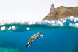
It is the beach where most turtle nesting occurs. It is a Park area, with permanent strict control. During nesting periods, no one goes down to the beach after 18h00.
Ponta das Caracas

At a rocky point, there are lovely natural pools in the middle of the rocks, which can be reached by descending the cliff.
Ahead is the deep blue sea. In the pools, colorful fish, rays and dogfish are the attraction of this area, currently prohibited for bathing due to the dangers that the descent provides. It is a National Park area, with permanent control.
Baía Sueste

With calm seas and gentle waves, this is a historic region, where the squadron that wanted to retake the archipelago from the Dutch landed in 1629.
It is an optional port for the times when the sea is rough. Guarding the bay, on the left, are the ruins of the Fort of São Joaquim do Sueste. Next to the sea, the only mangrove on an oceanic island, an ecological rarity.
Due to its importance as an alternative port, the BR 363 highway, which leaves from the port of Sto. Antônio, on the opposite side of the island, ends next to this bay. It is a National Park area, with permanent control.
Praia de Atalaia

Its landscape is reminiscent of the volcanic origin of the island: black rocks, reefs and the Morro do Frade, in the middle of the sea. On a small strip of land, only thirty people can stay, a requirement permanently controlled by IBAMA.
With the reefs uncovered, there is a large pool of intense marine life. At high tide, squirts are formed, which rise to great heights. In the left corner of the beach are the ruins of the Salina that operated there during the American presence during the war.
It is a National Park area, with permanent control.
Enseada da Caeira

A region of rock pools, surrounded by dunes (another ecological rarity), it is a steep cove, requiring care when walking between rocks. Large numbers of birds fly over the region. It is a National Park area, with permanent control and intense surveillance.
Buraco da Raquel

A contemplative region, it takes its name from a huge rock by the sea, with a large cavity, surrounded by shallow pools full of colorful fish. It is forbidden to go down there, on the assumption that it is one of the granaries of marine life that deserve to be preserved.
The name “Raquel” is attributed to the exceptional daughter of one of the military commanders who, in a crisis, used to hide there.
Ponta da Air France

Located exactly at the point where the inland sea and the outland sea meet, this is a historic region, where the French settled in the 1920s to provide aviation support.
It is not a bathing area; only for contemplating the sea and the secondary islands, among which – São José – houses the only fortification located outside the main island: the Fort of São José do Morro.
In the building that remains of the three that made up the old support base, is installed the Association of Artists and Artisans Noronhenses, in the so-called “Air France Cultural Space”.
Fernando de Noronha Beaches – Tourism and Travel Guide


