Este post também está disponível em:
Português
English
The geography, the complex network of rivers and the immense expanse of wetlands of the Pantanal plain in Mato Grosso make up a unique landscape on the planet, a heritage of all humanity.
A biogeographic corridor is the expression used by ecologists to refer to regions that allow the transit and dispersal of species of fauna and flora. This is exactly the role that the Pantanal, in the transition zone between the Cerrado, the Paraguayan Chaco and the Amazon, plays.

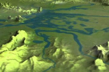
The largest set of wetlands in the world covers some 210,000 square kilometers, of which almost 140,000 are in Brazilian territory; located in the highest part of the Paraguay River basin, this gigantic system is structured along the Paraguay and Paraná rivers (middle and lower).
The Paraguay River, like the Paraná River in the Pantanal, is one of the few rivers on the planet free of dams.
But this immense quadrilateral is also drained by other extensive and flowing waterways: to the south, the Taquari River (800 kilometers), the Aquidauana River (565 kilometers), the Miranda River (490 kilometers) and the Coxim River (280 kilometers), and to the north, the São Lourenço River (670 kilometers) and the Cuiabá River (650 kilometers).

The Taquari River, which stretches for 500 kilometers through the Pantanal, is particularly important because of the length of its basin, which is around 29,000 kilometers.

Ciclo das Águas do Pantanal Matogrossense
GEOGRAPHY OF THE PANTANAL IN MATOGROSSO
1. FORMATION
Nature began to shape this showcase of wildlife around 60 million years ago.
It is estimated that Brazil’s Central Plateau rose in the Jurassic period, forming a huge shield that would eventually break and collapse. This is how the Pantanal plain came to be.
Over the geological eras that followed, the force of the elements transformed the territory into a flat surface, with almost zero slope, bordered by large plateaus 600 meters above its flooded bed.
Time has carved an unparalleled reservoir in the rocks, eternally fed by water from the rivers and tropical rains that swell in the Brazilian quadrant of the Upper Paraguay river.

2. MICRO LIFE IN THE WATERS
The rivers that supply the Southern Pantanal originate in the north from the Chapada dos Parecis, in the east from the Central Plateau and in the south from the Bodoquena mountain range.
When the rivers overflow their beds, they promote the dispersal of the local microflora and microfauna; thus, a large number of crustaceans, molluscs and fish are distributed throughout the bays (the regional name for the lakes), corixos (connecting channels between the bays) and marshes.
The number of microalgae per liter reaches 500 million, more than what occurs in the Mississippi and Nile deltas, two of the most fertile regions on the planet.
The earth, sand and silt act as a brake on the waters that flow from the great plateau that surrounds the Pantanal.
Because of these sinuous alluvial fans, they already arrive slowly, without enough energy to overcome them.
With the riverbed choked by tributaries, the banks flood and a shallow sheet of water forms, soon thickened by the abundant rains.
The springs located in the headwaters and low mountain ranges around the Pantanal feed 175 rivers and, during the floods, the waters advance over their banks.
The vast, flat expanses of land give rise to a closed sea, with intense underwater movement.
The sandy elevations that serve as shelter for cattle are spared from flooding.
When the ebb comes in June, the waters recede and nutrients, as well as animal and plant microorganisms, are deposited in the soil.

3. VARIOUS PANTANAIS
Fields with bays and capes, flooded fields, mountain ranges with salt lakes, galleries of riparian forest, thorn trees: variety characterizes the Pantanal.
The landscapes of the Mato Grosso Pantanal are interspersed and form a unique ecosystem in which the relief and hydrography interact deeply.
To better understand the fragments that make up this whole, the Pantanal has been divided into eleven sub-regions – “small wetlands” – each with its own characteristics and history: Nabileque, Miranda, Aquidauana, Abobral, Nhecolândia, Paiaguás, Barão de Melgaço, Poconé, Cáceres, Paraguay and Porto Murtinho.
The Nhecolândia wetlands, for example, where there are saline, freshwater bays with camalote vegetation, or even bare vegetation, were named after the owner of one of the oldest farms in the area.
This region has been increasingly impacted by the replacement of the gallery forest on the banks of the Taquari River, which feeds the area, by pastures, which causes silting.
Between the Bodoquena mountain range and the Paraguay river is the Nabileque wetland, which, along with the Paiaguás wetland, between the Taquari, São Lourenço and Itiquira rivers (also called Piquiri), suffers the most severe flooding.
In the Poconé wetland, between the Cuiabá and Paraguay rivers, gold mining has silted up rivers and caused a reduction in fish fauna.
The Barão de Melgaço wetland, near Chapada dos Guimarães to the north, is between the Cuiabá and Itiquira rivers; it has extensive areas of savannah, much of it covered in grass.
Between the Paraguay River and the Chapada dos Parecis is the Cáceres Pantanal, whose predominant vegetation is savannah and grassland, although there are also stretches of tropical rainforest, due to its proximity to the Amazon region.
The Paraguay pantanal, which is bordered to the west by the Serra do Amolar and the Urucum massif, has flooding periods of more than six months.
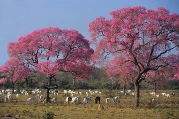
The Aquidauana swampland, like the Miranda swampland to the west, is less affected by floods; the latter is home to large expanses of carandás and paratudos, the regional name for the ipê tree.
The Abobral wetland, to the east of the Paraguay river, is one of the lowest and one of the first to flood.
To the south, the pantanal of Porto Murtinho has chaco vegetation and annual flooding. These “small wetlands” are usually grouped into two large regions: the Southern Pantanal (in the state of Mato Grosso do Sul) and the Northern Pantanal (Mato Grosso).
4. CLIMATE AND SOIL
The Pantanal’s climate shows marked differences between the dry and rainy seasons; it is predominantly tropical, free from oceanic influences.
It is exposed to the invasion of cold masses from the southernmost portions, with rapid penetration through the pampa and chaco plains.
The temperature can drop rapidly and even cause frosts, with minimums around 0 °C, while maximums reach almost 40 °C, with annual averages of 25 °C.
The dry season, with rain showers and pleasant temperatures, lasts from May to September.
In July, the crux of the drought, water is restricted to the riverbeds or the marshes and lagoons located in the lower portions of the plains.
In November the rains begin, which reach their peak in January and February and last until March – this is the Pantanal summer.
In this period, about 80% of the Pantanal floodplains are inundated. Flooding occurs initially in the north, then gradually flows southwards, where these floodwaters combine with the southern region’s high rainfall to result in its inundation around two months later.
Total annual rainfall across the region ranges between 1,000 and 1,250 mm.
This is actually less rain than other neighboring states, and means that the Pantanal could be technically classified as semi-arid.
Most of the rainfall occurs in the months from November to March.In the cooler months of the dry season, the temperature averages around 24 °C, but can experience sudden drops coinciding with the arrival of cold storm fronts from the Andes.
This typically occurs in July, and is locally known as the friagem, with temperatures dropping as low as -1 °C for short periods. By contrast, temperatures in the hottest months can exceed 40 °C and become very uncomfortable due to rain and high humidity.


The temperature rises and only drops immediately after the heavy downpours. During this period, the region, which is humid and hot, turns into a huge wetland where rivers, marshes and lakes mix.
The soil, influenced by the rainfall, varies from waterlogged in summer to dry in winter.
The most common soil composition in the Pantanal of Mato Grosso is sandy-clay, which is considered poor in the deepest part, but very fertile in the surface layer, thanks to the deposition of organic matter.
The Pantanal suffers from a series of problems caused by human activity.
These include poorly managed pastures and soy and rice crops, which can increase the load of sedimentary particles in the rivers and cause erosion. In droughts, the extremely damaging practice of burning is common.
When human intervention takes place at the headwaters of rivers, the situation gets worse: as the movement of water is intense, the whole territory ends up being affected.
Thus, rivers that flow through areas with a lot of agricultural activity can carry sediment, pesticides and other debris onto the plains.
Even so, the Pantanal remains a kind of ecological paradise, an immense expanse of unspoiled rivers and wetlands.
The challenge – for residents, authorities, tourists and all Brazilians – is to keep it that way for generations to come.
See the following publications on the Pantanal of Mato Grosso:
- Watching Mammals and Reptiles in the Pantanal
- Fishing in the Pantanal – Best places, baits, methods and seasons
- Most common fish species in the Pantanal
- Bird watching in the Pantanal of Mato Grosso
- Most common bird species in the Pantanal of Mato Grosso
- Flora of the Pantanal of Mato Grosso
- Fauna of the Pantanal of Mato Grosso
- Mato Grosso Pantanal – Geography, Climate, Soil and Rivers
- History of the Mato Grosso Pantanal – Discovery and Economic Development
- Southern Pantanal Region
- North Pantanal Region
- Why go to the Pantanal in Mato Grosso?


