Este post também está disponível em:
![]() Português
Português ![]() English
English

Marimbus lies between the municipalities of Lençóis and Andaraí and the starting point for the semi-arid mini wetlands of Bahia, or simply, Marimbus, is from the Quilombola Community of Remanso, located about 20 kilometers from the city of Lençóis.
The Quilombola Community of Remanso is recognized as cultural heritage by the Ministry of Culture and originated in the 1920s. Currently there are about 300 Afro-Brazilian inhabitants.
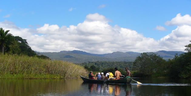
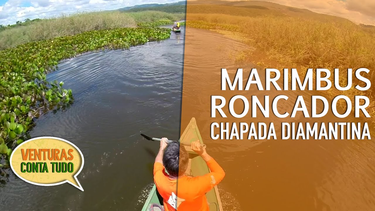
In the Quilombola Community of Remanso begins the tour to Marimbus. Canoes or rowing boats are rented to go down the river to the Roncador waterfall, where it flows into the São José River.

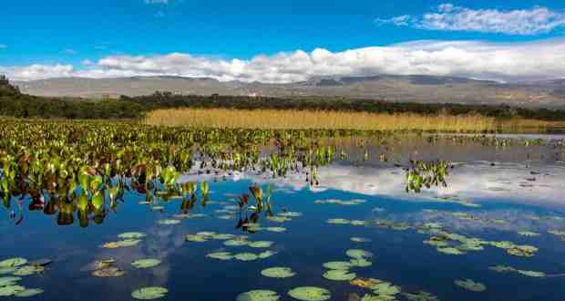
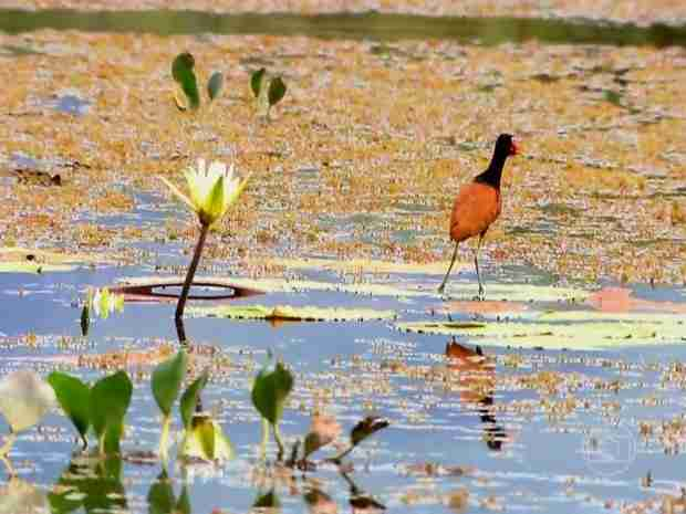
Marimbus is considered an environmental protection area and the stunning scenery allows you to see the fauna and flora of the region with aquatic flowers similar to those existing in the Pantanal Matogrossense and Amazonense.
The Chapada Diamantina, in addition to caves, waterfalls and hills, offers other options for incredible tours such as the famous Marimbus Walk, also known as the mini pantanal of Chapada Diamantina.
Watch the videos about Marimbus is the mini pantanal of Chapada Diamantina

Pantanal de Marimbus Parte 1
Pantanal de Marimbus Parte 2
Pantanal de Marimbus na Chapada Diamantina
Pantanal de Marimbus - Natureza
Marimbus e Rio Rocador na Chapada Diamantina02:43
It is a tour of Chapada da Diamantina not to be missed by adventurers and those who are willing, since to get to Marimbus you have to row for about an hour and a half to get there, plus two rowing against the current to return.
Map of the Trails and Tourist Spots of Chapada Diamantina
Route to Marimbus and Rio Roncador from Lençóis
Travel by car for 40 minutes to Remanso (remaining village of slaves, quilombola community), 15-minute walk to the bank of the Santo Antônio River to continue by boat (1h. and 30min) through a flooded region, with many aquatic plants, called Marimbus (known as the mini-pantanal of the chapada).
After the boat ride, walk for about 30 minutes until you reach the Roncador River, for a pleasant bath, in numerous natural pools with small falls providing hydromassage.
Marimbus wetland in Chapada Diamantina
At the foot of the eastern slope of the Serra do Sincorá, in the Chapada Diamantina, the Marimbus wetland is a large floodplain with a network of interconnected lagoons of calm waters, fed by the Santo Antônio River.
All the water collected by the mountains on its northern and northeastern slopes passes through it, from the outskirts of Vale do Capão, in Palmeiras (where the sources of the Santo Antônio River are located, still under the name of Rio Preto) to the Garapa River, near Andaraí, including the São José River, which flows from Lençóis to the south, receiving tributaries such as Ribeirão, Capivara, Capivari, Caldeirão and Funis, and the Roncador River. In addition to the waters of the mountains, it also receives drainage from the piedmont to the east, through the Utinga river basin.

Thus, practically all tourist attractions with water north of Andaraí – Fumaça, Mixila, Ribeirão do Meio and Mosquito waterfalls, Serrano, Mucugezinho, Poço do Diabo, Pratinha cave, among others – give their waters to this unique ecosystem called Marimbus.
Of African origin, the word marimbus means, in a Bantu dialect spoken in Angola, “roça, far from the village”. A region of fertile soil and abundant water, this floodplain became known as the Marimbus Pantanal.
Four major areas, each with dozens of lagoons, make up this extensive wetland, approximately 30 km in a north-south direction and ranging from a few hundred meters to a few kilometers in an east-west direction: Marimbus do Remanso, right at the confluence of the Utinga River with the Santo Antônio River, Marimbus do Ferrreira and Fazenda Velha, in the central portion, and the Marimbus do Baiano or Andaraí.
In this final stretch where the wetland, framed by the Sincorá mountain range in the background, expands into large lagoons that concentrate birds and colorful aquatic vegetation in a cinematic setting and serene landscapes of water mirrors, is the Marimbus Farm, a private area protected to conserve part of this amazing environment in the hinterland of Bahia.
Marimbus is home to the largest fish in the region, such as the Tucunaré, as well as capybaras, caimans and numerous species of birds. The community of Remanso, 45 minutes from Lençóis, is the gateway to this mini wetland.
In small wooden boats equipped with a paddle, or kaiak (available for rent), the crossing is made in one hour and forty minutes, until the mouth of the Roncador River, where we leave the canoe and walk.
Chapada Diamantina Tourism and Travel Guide in Bahia


