Este post também está disponível em:
![]() Português
Português ![]() English
English

History of Itaparica Island
The island of Itaparica was discovered by Europeans on November 1, 1501 by Américo Vespúcio, along with the Baia de Todos os Santos.
However, the island was already occupied by Tupinambás Indians.
The European occupation of the island of Itaparica took place from a small settlement nucleus founded by Jesuits on the back coast in 1560, where today is located the village of Baiacu – then called Vila do Senhor da Vera Cruz.
During this period, the planting of sugar cane was initiated there, as well as the cultivation of wheat, having received the first specimens of cattle in the region. It was also in Baiacu that the religious built the first hydraulic engineering project in the colony: a dam to supply drinking water and services to the settlement.
See the map of Todos os Santos Bay
The wealth generated on the island of Itaparica in this short time led to English Corsairs attacking the island as early as 1597. Between the years 1600 and 1647, it was invaded by the Dutch. During the last of these invasions, the Dutch even built a fort in the town of Itaparica called Forte de São Lourenço.
Ilha de Itaparica - Guia de Turismo

Ilha de Itaparica - Dicas de Viagem
Ilha de Itaparica - História

Ilha de Itaparica - Documentário
Itaparica Island was the scene of an important battle during the Bahia Independence struggles, between 1821 and 1823.
It was in Itaparica that the first steam engine was installed in Brazilian lands, in the Ingá-Açu mill.
The island was emancipated from Salvador on August 8, 1833 and elevated to a city on July 30, 1962. Subsequently, the municipality was dismembered into two: Itaparica and Vera Cruz.
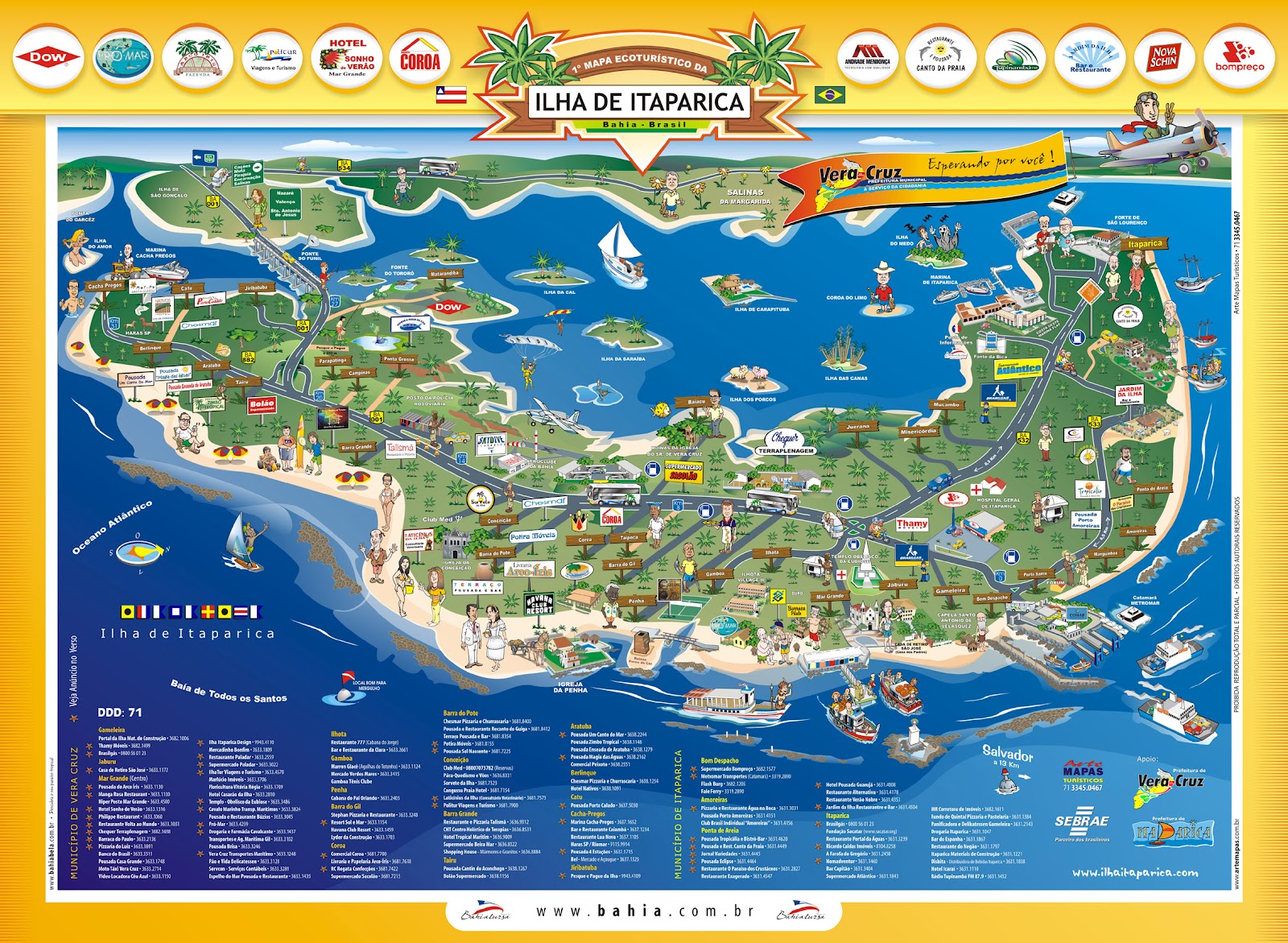
Tourist Attractions of Itaparica Island
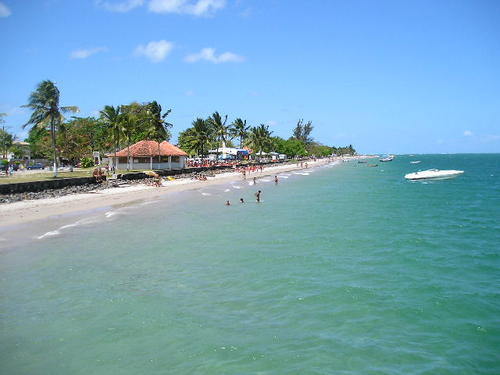
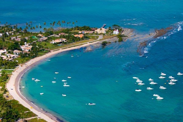
Itaparica Island is one of the most beautiful islands of the Brazilian coast. Its coast, in great extension, is surrounded by coral reefs, called “Pinaúnas Reefs”, which extends from Bom Despacho to Ponta de Aratuba.
The Pinaúnas Environmental Preservation Area was established by Decree-Law 467 of October 20, 1997.
Itaparica Island is 45 minutes from Salvador by ferry or by the Mar Grande maritime transportation system; and is connected to the mainland, at the southeast end (Funil Strait), by the João das Botas bridge via BA-001.
The town of Itaparica is the only seaside hydro-mineral resort in the Americas. Its water is carbonated and sulphated with a good dose of carbonic acid, radiative content at source at twenty degrees centigrade of 0.82 males. It has digestive and diuretic powers and is recommended especially for patients with liver and spleen problems.
Another attraction of the town is the popsicle seller Picoleixon, a folkloric local figure. He has created names that end with “eixom” for the flavors of the popsicles he sells. This native of the city has participated in several television reports, including the famous Jô Program.
Preservation of Itaparica Island
In addition to its historical importance and geographical uniqueness, Itaparica Island has one of the most pleasant historical and architectural ensembles, beaches with warm waters, diverse folklore, its own handicrafts and cuisine that is one of the most appreciated in all of Brazil.
The historical records about the island are very rich, highlighting the coming, in 1510, of the Portuguese navigator Diogo Álvaro Correia, the Caramuru.
The famous shipyards of Itaparica Island were also the emporium of the colony’s naval constructions: the first keel of the Brazilian Navy was built there. At this time, there were also five brandy distilleries, as well as lime factories (nine in the mid-19th century). However, the island’s main economic activity was whaling, especially during the 17th and 18th centuries. For this reason, before being called Itaparica, it was known as Arraial da Ponta das Baleias.
The island of Itaparica is located thirteen kilometers, via ferry, from Salvador and is the largest of the 56 islands of the Bay of All Saints.
It has more than forty kilometers of beaches (average temperature of 24.5 degrees Celsius), with abundant tropical vegetation, where exuberant coconut groves predominate, having in front, the city of Salvador, separated by the Bay of All Saints.
“The island”, as it is affectionately called by its residents, vacationers and tourists, has 146 square kilometers and 55 000 inhabitants distributed in two municipalities: Itaparica, where is located the only source of hydromineral water by the sea of the Americas.
The municipality of Vera Cruz, on the other hand, has the luxury of having its headquarters named Mar Grande. Therefore, the municipality of Vera Cruz has, as its urban area, the locality of Mar Grande.
Between Itaparica, the seat of the municipality, and Cacha Pregos, the extreme points of the island’s coast, there are beautiful beaches with excellent conditions for bathing and safety. A line of reefs serves as a breakwater, reducing the force of the waves and forming a natural nursery for octopuses, lobsters and other shellfish. Most of these beaches have shallow, calm and warm waters.
The island has and offers quality services at all levels – restaurants with delicious seafood, boat trips, skydiving and a multitude of entertainment options.
Documentary about Itaparica Island in Bahia – Itaparica Island Tourism and Travel Guide


