Este post também está disponível em:
![]() Português
Português ![]() English
English

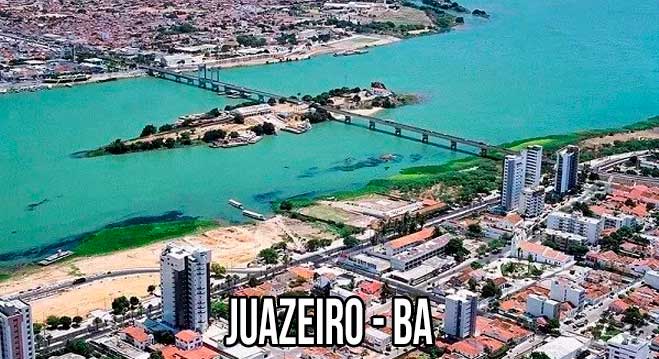
Juazeiro is a Brazilian municipality in the state of Bahia and lies on the banks of the São Francisco River.
Juazeiro is situated in the sub-middle region of the São Francisco river basin, and together with the neighbouring Pernambuco municipality of Petrolina forms the largest urban agglomeration in the Brazilian semi-arid region.
Anyone who imagines that Juazeiro, in the north of Bahia, on the banks of the São Francisco River, is a harsh and backward place, is mistaken.
The city is modern, with new buildings and paved streets lined with carnauba trees.
On the riverfront there is a public promenade where locals go to watch the sunset and enjoy the scenery.
The São Francisco has several river islands in the Juazeiro region.
See the map Lagos de São Francisco.
Massanganos is one of the favourites of the young people, who organise luaus by the light of bonfires that only end at dawn. For trekking lovers, there are trails that lead to the mountains and to the cave paintings on the walls of a large canyon.
HISTORY OF THE CITY OF JUAZEIRO
From the former port of passage for drovers and traders who travelled through the hinterland, the leafy juazeiro trees – the name that gave rise to the municipality – and some monuments of civil architecture from the last century remain for the historical record.
A thriving trade developed on the banks of the São Francisco River, at the main border point between the states of Bahia and Pernambuco.
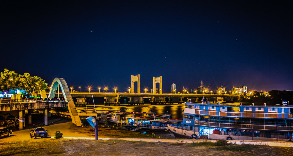
Juazeiro has become a modern agro-industrial centre, with intense export activity. The city has modernised with the urbanisation of the riverfront and the new look of the arches of the Eurico Gaspar Dutra bridge, now occupied by small bars and restaurants.
Significance of the Name
Due to the Juazeiros, trees present in the region, since the time of the foundation.
Juazeiro is a modern agro-industrial centre located on the right bank of the São Francisco River, on the border with the state of Pernanbuco.
It is considered the Land of the Carrancas, half-man and half-dragon faces, used by boats travelling up and down the São Francisco to ward off evil spirits, shadows, water eyes and the devil.
Main Tourist Sites of Juazeiro
1. Ilha do Rodeadouro
Located 12 km away from the centre of Juazeiro, it is one of the most frequented islands in the region, with white sandy beaches and excellent for swimming. With a reasonable infrastructure, the island has tents where visitors can taste the most varied dishes of the region.
There is also space for camping, where people can spend the weekends enjoying the natural beauty of the place.
The crossing can be made by boats located on the banks of the São Francisco River in the village of Rodeadouro or on the tour boats that leave every weekend from the Juazeiro pier to the island. During the journey people enjoy live music while contemplating the natural landscapes of the Velho Chico.
2. Fire Island
The island is located in the centre of the Presidente Eurico Gaspar Dutra bridge, marking the border between the states of Bahia (Juazeiro) and Pernambuco (Petrolina). It has a beach area with rugged terrain, formed by a single rock, approximately 20 m high, where a cruise is fixed.
3. Blame the Wind Island
The island is deserted and ideal for wild camping. Access is via the BA 210 motorway, which connects Juazeiro to Curaçá, approximately 15 km to the crossing point which is made by boats located on the banks of the river.
4. Ilha de Nossa Senhora
It is 2 Km away from the headquarters, it has an exuberant and varied vegetation with predominance of mango and cashew trees, an area of white sandy beaches and crystal clear waters. It is one of the most frequented islands, due to the beauty of its beaches.
5. Salitre Waterfall
Located in the Salitre Valley, in Fazenda Félix, 39 km from Juazeiro, the waterfall with a jump of just over 2 m high is excellent for bathing and much appreciated by the children of the region, who have fun in the waters of the Salitre River. Access is via BA 210, towards Sobradinho.
6. Gameleira Waterfall
Also formed by the Salitre River, the Gameleira Waterfall is 68 km from Juazeiro, hidden among the closed vegetation of the caatinga.
In a paradisiacal setting, the waterfall flows between a canyon, where a huge gameleira predominates, whose roots spread out forming shade in part of the waterfall. The depth of the lake allows jumps from the top of the waterfall of approximately 5 m.
7. Grotto of the Convent
Located 100 km from Juazeiro, it is an unmissable adventure for those who enjoy ecological tours.
Curtains and towers are formed by the stalactites and stalagmites that give shape to the cave of 40 m wide and 30 m high, also composed of two lakes making the scenery more beautiful. A native guide is required to visit the cave.
8. São Francisco Valley
The São Francisco River Valley has interesting cities and natural beauty different from the rest of the State of Bahia, especially the coastal strip, and worth knowing.
How to get there
Leave Salvador, by the BR-324, until Feira de Santana. From there, you should go to Capim Grosso, for about 20 km, where you will find the junction with BR-116, which gives access to Juazeiro.
Location
Municipality of the São Francisco Valley Region in the State of Bahia
Boundaries
Curaçá, Sobradinho, Campo, Formoso, Jaguarari, Petrolina (PE) and Lagoa Grande (PE)
Road Access
BR-116
Distances
It is 500 km from Salvador
Bahia.ws is the largest tourism and travel guide of Bahia and Salvador


