Este post também está disponível em:
![]() Português
Português ![]() English
English

Formerly the Old Parish of Santo Antonio do Sertão da Jacobina, its baroque name recalls the 17th century period.
Campo Formoso was the first settlement that emerged in the north of Bahia. In 1682, the village was elevated to the category of Parish by the 1st Archbishop of Bahia, D. Gaspar Barata de Mendonça.
Jacobinas were called in Bahia, the lands of low and thorny vegetation that formed the hinterland. It was inhabited by the Indians sapóias, paiaiás, tocós, secaquerinhens, all belonging to the group of the Quiriris, forming the great nation of the Tapuias.
The first Portuguese to arrive in Jacobinas were the bandeirantes from Bahia.
Amongst them are: Belchior Dias Moréia, the discoverer of the legendary silver mine and his son Robério Dias, the lord of Casa da Torre Francisco Dias D’Avilla and his brother Father Antonio Pereira, founder of sesmaria where the lands of the Old Parish of Santo Antonio da Jacobina were included; the brothers Manoel and João Calhelha and Lourenço de Matos, discoverers of the Jacobinas who moved to the settlement of Freguesia Velha “where they lived and died”; Bento Surrel, discoverer of the saltpetre and salt mines in the valley of the River Salitre.
Campo Formoso na Bahia
Campo Formoso - Terra dos Minérios04:42
Curiosidades sobre as esmeraldas de Campo Formoso
The first missionaries arrived in the hinterland of the Jacobinas in 1655, finding at that time more than eighty villages formed by various tribes; the Sapoiás, the Paiaiás, the Eveninhens, etc.
On 22 July 1722, by order of the Vice King of the State of Brazil, the sertanista Pedro Barbosa Leal, installed the village of Santo Antonio de Jacobina, in Sítio do Sahay, near the Mission of Nossa Senhora das Neves do Sahay.
The choice of this location was motivated by the refusal of the vicar of the Old Parish of Santo Antonio and the lord of the Tower House, who did not accept the installation of the village of the arraial of Santo Antonio, seat of the Old Parish of Santo Antonio.
Two years later the village was transferred to the Mission of Bom Jesus da Glória de Jacobina Nova (today the city of Jacobina)
The main driver of progress in the region of Freguesia Velha de Santo Antonio was the exploitation of saltpetre ore in Pacuí (Nossa da Encarnação workshop) and in the mines of João Martins and João Peixoto.
This ore was transported on donkeys’ backs to the port of Bahia and then on to Portugal. From saltpetre was extracted the gunpowder used in the war industry.
Then came the period of cattle breeding, with the installation of farms and corrals administered by overseers, cowboys and drovers.
In the year 1770, the residents of the Arraial da Freguesia Velha, sent to King José I a large petition for the town to be elevated to the category of village.
Despite reasonable arguments, no decision was taken in this regard. And the village of Santo Antonio waited 110 years for this desire so longed for by its population to happen.
It was on 28 July of the glorious year of 1880 that by Provincial Law no. 2051, signed by the Governor of the Province of Bahia, D. Antonio de Araújo Bulcão, the village of Campo Formoso (former Old Parish of Santo Antonio do Sertão da Jacobina) was created, with all the limits of the Parish. Its installation took place three years later, in 1883.
In 1939, its seat was elevated to the category of city, by Decree – Law No. 11,089 of 30 November 1938.
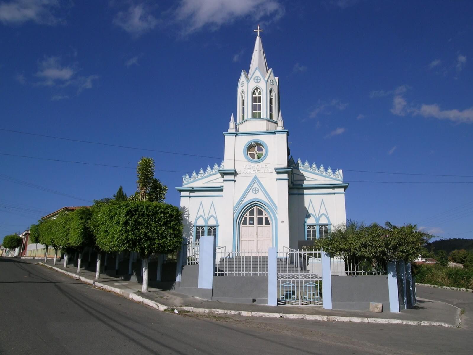
Located on the slopes of the Serra da Jacobina, Campo Formoso is a city full of slopes and hills.
The commercial centre, government offices, hotels, hospital, churches and old residences are located on the Morro dos Alecrins.
With progress, the city has grown towards the hills that surround it, forming several neighbourhoods: Esplanada, São Francisco, Vila Pernambucana, Vila dos Sonhos, Bosque das Mangueiras, Santa Luzia, Colina do Sol, Baixa dos Tapuias, Serra do Cruzeiro, Centro Cultural, Guabiraba and others.
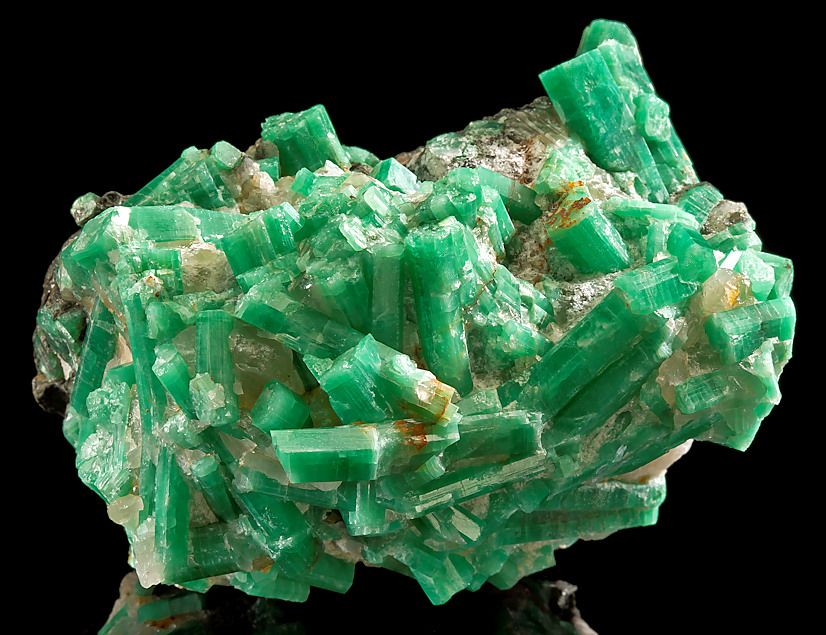
Stone Art – Emerald Mining
See also Fruits of Campo Formoso in Bahia
Emerald mining in the Serra da Carnaíba, in Pindobaçu, 42 kilometres from Campo Formoso, in Bahia, began in 1963, in the Jacobinas chain of mountains.
In the 1980s, the precious stones extracted there accounted for all emerald production in Brazil and 25% of total gem exports, with the exception of diamond.
Twenty years later, a new deposit appeared at Fazenda Piabas, in Campo Formoso, known as the “City of Emeralds”. It soon became the Socotó gold mine, whose production surpassed that of Carnaíba.
However, not all emeralds are precious and around them are grouped various types of rock, such as biotite – a stone from the mica or malachite group, made up of potassium, magnesium, iron and aluminium – and granite.
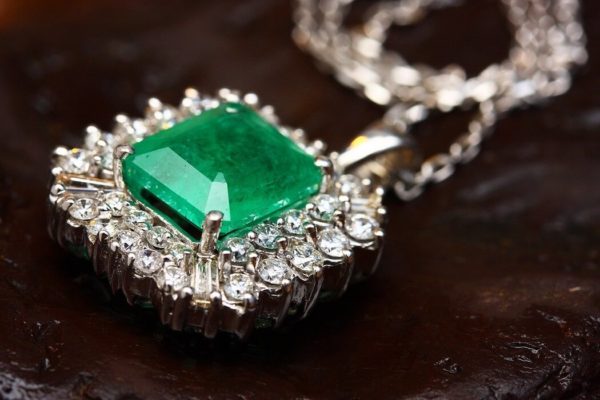
It is from this material that the Campo Formoso Association of Mining Artisans produces handicrafts, which are sold in cities in five states, including the state of origin.
All of the association’s directors learnt to make everything from the famous colts carrying hunuás, filled with green stones, to beautiful images of miners and religious inspiration at the state government’s handicrafts school.
Campo Formoso – Geography
The municipality of Campo Formoso is located in the north of Bahia, west of the Jacobina mountain range. Its history dates back to the beginning of the colonisation of the interior lands of Brazil-Colony (XVII century). In its area is located the Salitre Valley, whose river of the same name is a tributary of the right bank of the São Francisco River.
Campo Formoso is 400 km from Salvador, which is accessed by the BR-324 to Senhor do Bonfim from there 24 km through asphalt track that connects the two cities. Despite its proximity to the caatinga, the city has a mild climate, with nights aerated by the trade winds channelled through the chain of mountains that surround the region.
Location: Polígono das secas , North of the State of Bahia, region of Vale do São Francisco, micro-region of Senhor do Bonfim.
See the map of the Geographical Situation
Boundaries
North: Juazeiro and Sobradinho.
South: Antonio Gonçalves, Mirangaba and Umburanas.
East: Senhor do Bonfim and Jaguarari.
West: Sento Sé
Bahia.ws is the largest tourism and travel guide for Bahia and Salvador.


