Este post também está disponível em:
![]() Português
Português ![]() English
English

Maranhão is the synthesis state of Brazil. Here characteristics of the North, Northeast and Midwest converge.
Different nuances of climate, vegetation, hydrography, coastline, relief, history and culture blend together amid a tropical panel of colors, flavors, sounds, textures, smells and stunning landscapes that portray the Brazilian joy of being from Maranhão.
Discovering the Maranhão in its entirety is equivalent to a trip to the Amazon, the Northeastern Hinterland, the Cerrados of Central Brazil, the North and Northeast Coast, the Chapadas, the Sierras, a congener of the Pantanal and all the unique contact (transition) areas between these ecosystems; in a single trip.
In the midst of so much diversity, the peculiarities also reserve good surprises. The most mixed people in the country created and knew how to preserve, amidst the natural and built beauties, one of the most significant, original, authentic and rich Brazilian cultural manifestations.
THE ENVIRONMENTAL RICHES OF MARANHÃO
Maranhão is what we can call the “Amazonian Northeast” or “Northeastern Amazon”, north and at the same time northeast, or even “mid-north” or ¨middle-northeast¨.
A riqueza ambiental do Maranhão - Arquipélago de Maiaú
This Brazilian state has a very privileged location: it is at the eastern end of the eastern Amazon and at the northern/western end of the Northeast.
Politically it is Northeast (before it was the “Mid-North”), geographically it is a mixture of North-Northeast and culturally, marked by the indigenous, white and strong black presence, it is something that only the meeting (or the “middle ground”) of these / between these two Brazilian regions and the intense miscegenation of its people could produce, with a lot of its own thing, which only has here, evidenced by its rich cuisine, crafts, history, folklore, popular culture and music.
It is exactly where these two great and distinct regions, added to an “extension” of the central plateau of Brazil, meet, creating a unique and essentially Brazilian moment, both geographically and culturally.

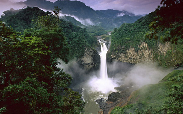
Maranhão’s varied landscape includes Amazon rainforest, pre-Amazon forests, cocais, valleys, cerrados, caatingas, carrascos, rivers, chapadas, caves and grottos, vast plains, mountain ranges, waterfalls, tabuleiros, bays, gulfs, sands, dunes, lagoons, mangroves, palm groves, lakes, reservoirs, sea and river beaches, igarapés, cerradão, fields, flooded, floodplains, delta, islands, coconut groves, salt marshes, transitional forests of various types, corals, semi-deserts, etc., drawing a true tropical picture of the Brazilian geographical synthesis.
Its attractions are not concentrated only on the coast, as in the other northeastern states, nor are they mostly limited to its vast interior, as in the rest of the Amazon.
Maranhão has a huge space that houses such diverse landscapes and ecosystems
Each space with its typical flora and fauna, as those that exist in most of the country in a relatively small territory:

1. It has the longest coastline in Brazil. That’s right!
Maranhão has the longest coastline in Brazil because, considering all its cutouts, bays, gulfs, indentations and islands, it can reach more than 1000 km, therefore, larger than that of Bahia.
On one side is the Amazon coast and on the other, where the lençóis region begins, the northeastern coast or the dunes. (Officially, MA is considered to have the second longest coastline in Brazil – 640 km – taking into account the measurement in a straight line).
2. It has the largest number of islands on the Brazilian coastline
With the formation of many river and sea archipelagos, most of them still preserved and unknown, and the capital itself, São Luís, is on an island.

3. The largest area of mangroves in Brazil (50%)
With flora and fauna typical of the Coastal Amazon and the northeastern coast, contributing to one of the most fishy sea and a very high biodiversity.
The mangroves of Maranhão are exuberant, lofty and can reach 40 meters in height.
4. The pororoca is a unique and impressive natural phenomenon.
The pororoca of the Mearim River, where every year surfing competitions are held.
5. The largest preserved and unknown area
Of cerrados and chapadões in Brazil and South America.
The Maranhão savannah has unique characteristics and is the country’s newest agricultural frontier.
This area still maintains healthy populations of Brazilian fauna, with emphasis on endangered animals such as the maned wolf, the jaguar and the hyacinth macaw.
The Maranhão savannah has three large conservation areas of integral protection: the Chapada das Mesas and Nascentes do Rio Parnaíba National Parks and the Mirador State Park, the latter the largest conservation unit of integral protection in the state and the second largest of the cerrado biome in the country.
6. The largest coral bank in South America
Largely unknown due to the strong and dangerous sea currents that cross it: the Manuel Luis parcel, a refuge for various marine species and a treasure trove of shipwrecked vessels.
7. The largest open sea delta in the Americas
It is the third in the world, the Delta do Parnaíba or Delta of the Americas, with 75% of its area in Maranhão.

8. The largest lake basin in the northeast
in fact a kind of extension of the floodplains of the Amazon Basin and the fields of the Isla do Marajó, a true wetland: the Baixada Maranhense.
9. A unique landscape in the world
Similar to a desert, but totally opposite to it. There are 155 thousand hectares of dunes interspersed with crystal clear rainwater lagoons, rivers, mangroves, sandbanks and framed by the second longest beach in the country: Lençóis Maranhenses National Park.
10. An immense area of lush Amazon rainforest
Still preserved and unknown, but equally threatened, with many endemic animal species, such as the black cuxiú and the caiarara monkey and endangered ones such as the ararajuba (symbol bird of the country); inhabited by one of the last semi-nomadic peoples of Brazil and the world, the Awá-Guajá and other indigenous peoples: Gurupi Biological Reserve and adjacent and nearby indigenous areas (A.I Alto Turiaçu, Awá-Guajá, Caru and Araribóia).
11. An extensive hydrographic network of perennial and fishy rivers
While the western and northwestern portions (including much of the Golfão Maranhense and the Baixada Maranhense) plunge into the so-called Maranhense Amazon (34% of the state), the south of the state, also called the Alto Sertão Maranhense, is territory of the largest and most preserved Cerrado in the country.
In the central-eastern-northeastern portion of the state, there are areas of ecotones and ecological tension (transitions) between Amazon-cerrado-caatinga with unique ecosystems such as the cocais forest, Carrascos (transition forests between the cerrado and the caatinga), cerrados, small areas of caatinga, cerradões, pre-Amazonian cerrados and pre-Amazonian forests (in the correct asseption of this term, being forest areas of transition to the Amazon and not the Amazonian forest of Maranhão itself, as is most propagated); where elements of fauna and flora of these biomes are mixed.
The Pre-Amazon Forest and the Cocais Forest are trademarks of the state and represent our floristic individuality.
The transition forests become more exuberant, humid and biodiverse as they approach the Maranhão Amazon, and are then called Pre-Amazon Forests.

Towards the east (agreste maranhense), where they become less exuberant, more seasonal and with a greater density of babassu palm trees and species of the Cerrado and Caatinga, they earn the name Mata dos Cocais.
The Mata dos Cocais (not to be confused with the Babaçu plantations or “Babaçuais”, which populate previously deforested areas in almost the entire state) is one of the best known transitional ecosystems in the state.
Its biggest “star” is the Babaçu palm, symbol of Maranhão and the basis of the livelihood of many families in rural areas.
It is important to note that a large part of these original natural landscapes in Maranhão have already been anthropized, altered and/or deforested, with the exception of some conservation units, indigenous areas and most of the coast and the extreme south of the state.
Throughout the state, fragments and remnants of the surviving original forests and ecosystems are scattered and, in the areas previously deforested and then cleared, what is generally seen are secondary forests, capoeiras, capoeiras with babassu and babaçuais.
Proportionally, Maranhão is the state with the largest rural population in the country and is also part of the region of colonization and oldest settlement in the Amazon and the region called the “Arc of Deforestation”, with strong agricultural pressures on what remains of the Amazon and Cerrado in the state.
Maranhão suffers serious socio-environmental problems in rural and urban areas such as silting of rivers, pollution, deforestation, fires, illegal fishing and hunting, etc.
All this reflects in an irreversible drop in biodiversity, climate change, depletion of natural resources and a decrease in quality of life.
Guarás Forest in the Maranhão
The Guarás Forest is a small Brazilian ecosystem, located on the western coast of the state of Maranhão and bathed by the Atlantic Ocean.

This incredible ecosystem is made up of part of the Amazon rainforest in its fauna and flora, mangroves, forests, desert islands and sandbank areas. And it takes its name in honor of the beautiful bird of red plumage, common in the region.
The place, which has natural and cultural attractions, was included as an ecotourism center par excellence and involves the municipalities of Cedral, Mirinzal, Cururupu, Guimarães and Porto Rico do Maranhão.
It stands out as an ecological sanctuary formed by bays and estuaries where rivers flow amidst mangroves.
Among its greatest tourist attractions is the island of Lençóis, in Cururupu. Formed of sand, it presents stunning scenery.

There are also other attractions such as the beaches of Caçacueira, São Lucas and Mangunça, Parcel de Manuel Luís, a coral bank with reach only for professional divers; shipyards, where masters build typical boats of the state, totally handmade and several birds such as guarás, herons, spoonbills and teals.
In addition, there is a legend, that of the Enchanted Bull, which makes everything enigmatic. According to the belief, the King of Portugal São Sebastião, who disappeared during a popular fight against the Moors, lives there in the form of an enchanted bull.
In this tropical and preserved landscape, the lush mangroves can reach 35 meters in height and 1 meter in diameter are vital to the environmental balance of the entire coastal zone, especially for birds.
It is also where the largest population of manatees in Brazil is found. Among the reptiles, the boa constrictors and the sea turtles stand out.
The diversity of fish, shrimps, crabs, oysters, sururus and other marine animals are an indication of a good level of conservation of these mangroves.
For those who want to stay in the Forest, the number of accommodations is very limited, but this gives tourists the possibility to live a rare and unforgettable experience.
As the place is hot and humid, some items cannot be left out of the suitcase, such as: sunscreen, repellent, hat, moisturizer and lip balm.
There are three ways to get to the Guarás Forest: air access, leaving São Luís it is possible to charter an aircraft for six people, in the range of R$1,000; maritime access, boats make the transport for an average of R$38 per person; or land access, in which the bus leaves daily from São Luís, with eleven hours of travel.
The environmental wealth, flora and fauna of Maranhão
Tourism and Travel Guide of Maranhão and the Guarás Forest


