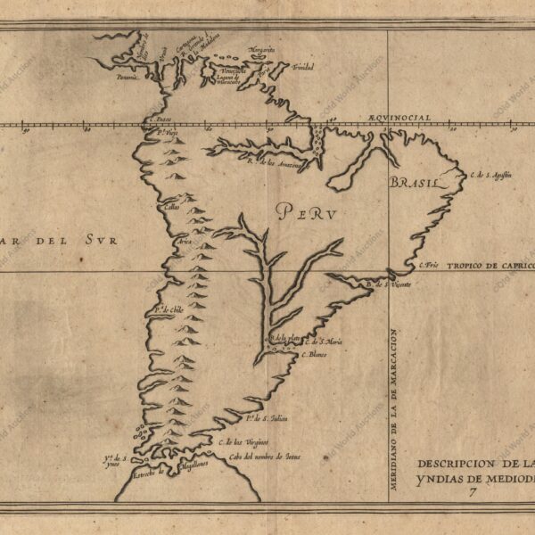
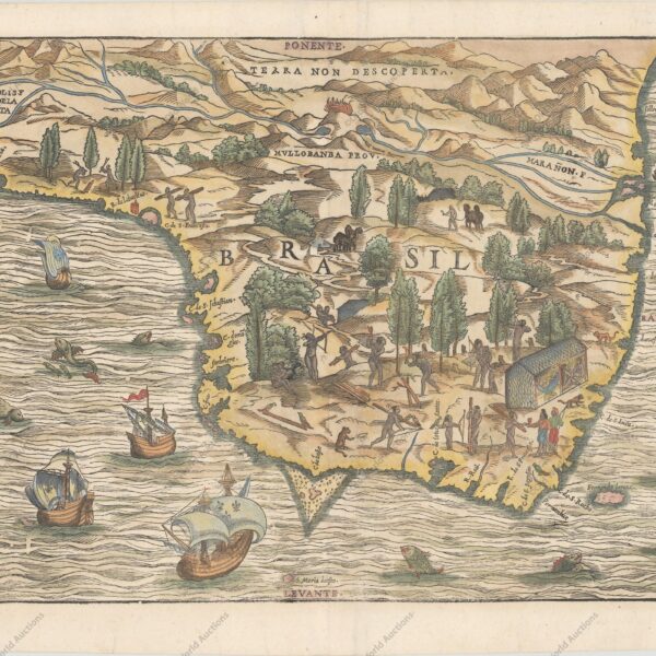
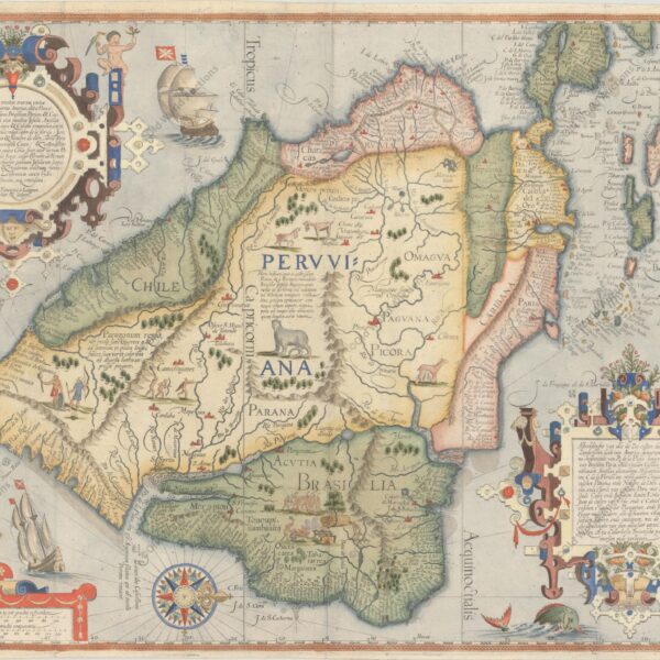
From the 16th century, the historical cartography of Brazil begins with the first representations that are part of the planispheres or maps of the Americas in editions of Ptolemy’s Geography and works by travellers.
These representations of Brazil have illustrations of indigenous scenes, fauna and vegetation, information obtained, at first, through Américo Vespúcio, who accompanied the first Portuguese expeditions to the Brazilian territory, and, later, through travellers and navigators.
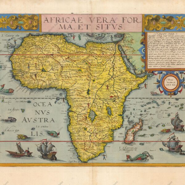
The cartography of this period also records the first names of the country: Terra de Santa Cruz, Terra Incógnita, Antropófagos, Terra dos Papagaios and Brasil. These maps were produced by cartographers such as Ruysch, Waldseemüller, Ortelius, Ruscelli, Forlani, Gastaldi and Hulsius. Still in the 16th century, the concern with the French attacks on the Brazilian coast began.
Examples of these episodes can be found in Gastaldi’s maps, exposing the barter between the French navigators and the Brazilian natives, and in the works of the religious and cosmographer André Thevet, who accompanied Nicolas Durand de Villegagnon during the time he was in Rio de Janeiro, with the foundation of the French Antarctic colony.
Between 1580 and 1640, Portugal was part of the Iberian Union, under the Filipino dynasty.
Thus, all the Portuguese colonies also belonged to the Spanish Crown, which favoured the presence of the French, English and Dutch on the northern and north-eastern coast of Brazil.
To defend the Iberian domains in America, the Philippine Crown allowed the Luso-Brazilians to go beyond the limits established by the Treaty of Tordesillas, advancing towards the Amazon delta.
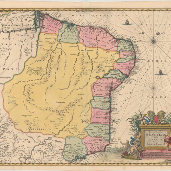
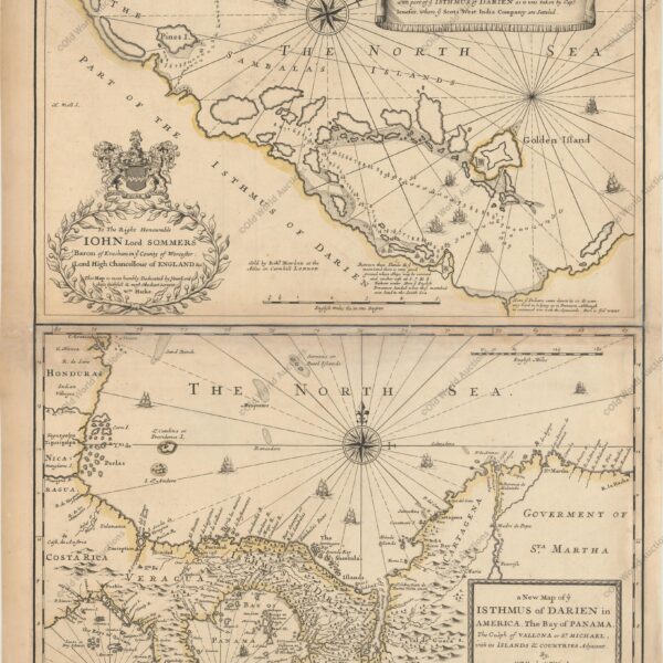
These conquests are recorded in the 17th century Portuguese cartography, by the notable astronomers Cochado and Albernaz I, showing the forts built and the cities founded, as well as the English and Dutch fortifications destroyed.
Still referring to the 17th century, the Portuguese handwritten cartography is displayed, with the charts of Antônio Vicente Cochado, Antônio Sanches, João Teixeira Albernaz I and his grandson João Albernaz II.
All maps detail toponyms richly located on the coast, from Belém to the Rio da Prata.
The map of Brazil by Albernaz II (1666) deserves, however, to be highlighted because, besides having, like the others, a large quantity of toponyms on the Brazilian coast, it highlights the city of São Paulo and, in the south of the territory, the Jesuit missions.
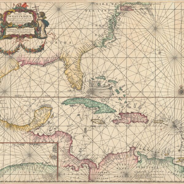
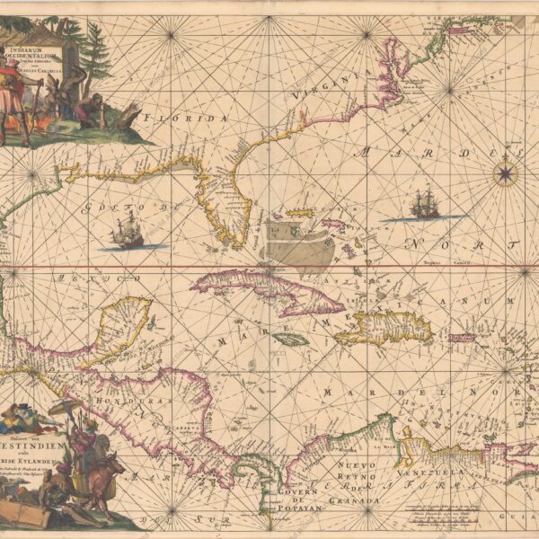
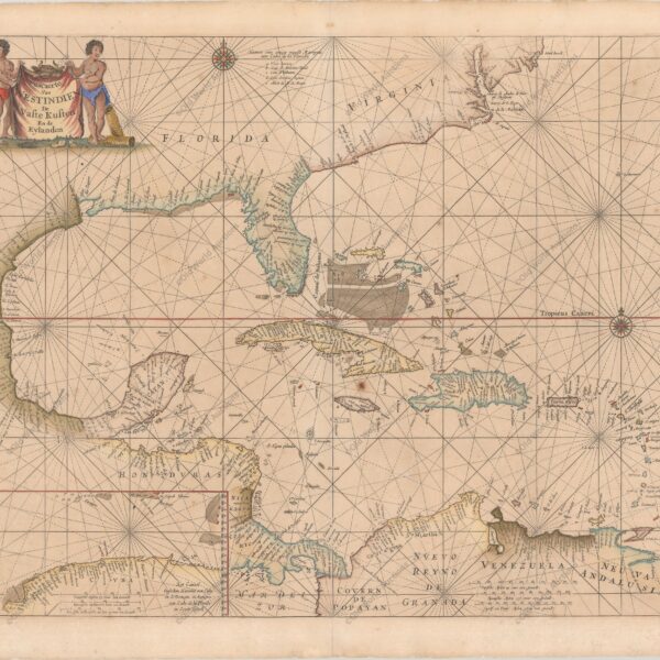
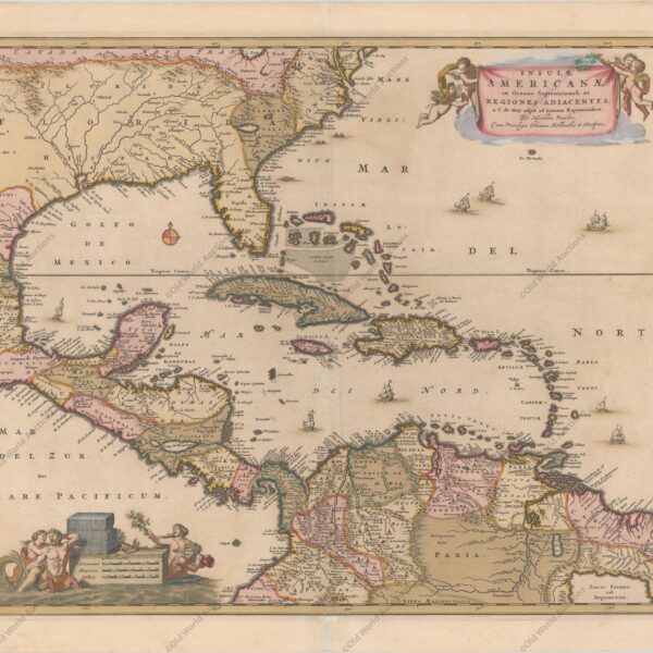
I could not fail to show the beautiful Dutch cartography of north-eastern Brazil, between 1624-1654.
The map, Perfect Caerte der Gelegentheyt van Olinda de Pharnambuco Maurits-stadt ende t’Reciffo and made by Cornelis Golijath, is considered the best cartographic production under Dutch rule in north-eastern Brazil.
In the 18th century, there is a sketch about the Luso-Brazilian explorations of the Brazilian interior, which is part of the set “Cartas Sertanistas” (Letters from the Backlands) (Cortesão, 1957-1971).
These sketches, existing in the National Library, indicate Jesuit missions destroyed by sertanistas and/or bandeirantes and roads in search of mineral wealth in the interior of Brazil.
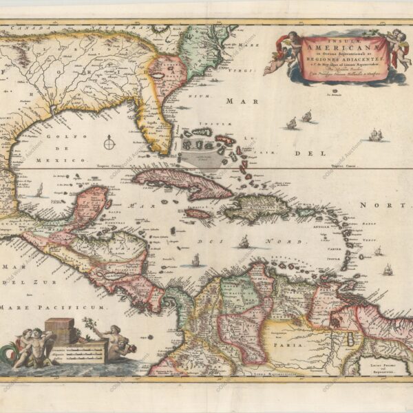
Still from the 18th century, we also find French cartography, which became predominant in that period with the foundation of the Royal Academy of Sciences by Colbert and the construction of the astronomical observatory in Paris.
Among the cartographers chosen were Guillaume de L’Isle and Jean Baptiste Bourguignon d’Anville, author of one of the best eighteenth-century charts representing South America.
The notoriety of Guillaume de L’Isle is due to the fact that he observed errors of the Portuguese in the calculations of the longitudes of Brazil.
A member of the Royal Academy of Sciences of France, Guillaume de L’Isle, in 1720, noted that the Portuguese calculations exceeded the Lusitanian domains in South America according to the Treaty of Tordesillas.
As is well known, the Iberian Crowns sought a solution to the question of the boundaries of their domains in South America.
The result of these negotiations was the Treaty of Madrid, signed in January 1750.
One of the original copies of the Map of the Cortes, the cartographic document that served as the basis for the treaty, is part of the exhibition.
Thus, mixed commissions were formed to survey and demarcate the borders of the northern and southern regions in South America. Portugal and Spain hired specialists (cosmographers, astronomers, military and other specialists) from various European nations to carry out these tasks.
From these works, a significant amount of cartographic documents (maps, views, reports, diaries) were produced.
The exhibition displays part of this collection produced by the members of these mixed commissions on the Portuguese side.
The 19th century begins with two leaves from the handwritten atlas Guia dos Caminhantes, made by Anastácio de Santana, in Salvador (1817).
The first, the title page, contains geographical data and a panoramic view of the city of Salvador.
The second is a map of Brazil with the north facing the right bank. Besides being didactic, this atlas represents one of the first initiatives in the mapping of Brazil.
In this period, cartographic production increases. Maps of provinces and of the national territory, topographic plans, hydrographic surveys of the rivers, of the Amazon and Prata basins and frontier charts are composed.
In the twentieth century, after resolving several border issues over four centuries, and with the national territory already configured, the route ends with the Carta geographica do Brasil (Geographic Chart of Brazil), on the scale 1:7,500,000, published by the Engineering Club in 1922, in commemoration of the centenary of Brazil’s Independence.
This map is the reduction of the letter of Brazil in the International Letter of the World to the Millionth, made according to international standards established at the International Congress of Geography in Paris in 1913.