Este post também está disponível em:
![]() Português
Português ![]() English
English

Pacatuba is a Brazilian municipality in the state of Sergipe. The beautiful history of the foundation of the municipality of Pacatuba, 116 kilometres from Aracaju, would deserve a separate study. As historians say about the lands that make up this municipality, it is settled on a vast plateau.
Pacatuba is a flood plain and there is a great biodiversity. There are more than 100 catalogued species, with many fish, mammals, birds and ornamental plants.
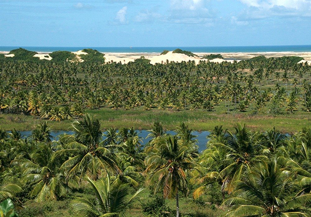
The northeastern wetlands, or pantanal sergipano, were formed more than 12,000 years ago. The region is about 40 km long and can be admired on the route that connects Pacatuba to another beach on the north coast, Pirambu.
The Sergipano Pantanal is part of the Santa Isabel Biological Reserve, which protects the beaches, dunes and lagoons of the region, so it is vitally important not to leave traces and rubbish in the area.

It is possible to reach the place by BR-101 by the road to Japaratuba, but to contemplate the beauties of the region it is necessary to go or return to Pirambu by the dirt road.
The most beautiful place is the Mirante do Robalo, where it is possible to visualise the set of beauties that are in the region.
The region on the coast of Sergipe has its own vegetation and fauna. Species have been little studied or have not yet been inventoried by science.
From sunrise to sunset, Pacatuba, on the north coast of Sergipe, displays enchanting scenery. The region is on the border with Alagoas and almost on the banks of the São Francisco River, which flows into the sea a few kilometres from the municipality.
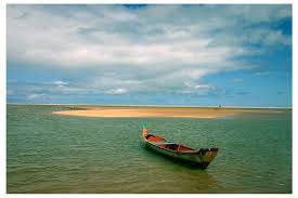
Most of the 14,000 inhabitants live from fishing, coconut production and cattle breeding. The region has a unique relief, which intersperses hills and flood plains. To get to the beach you have to face 20 kilometres of a sandy road and climb some dunes, but the effort is worth it.
The place is so beautiful that it is practically impossible to choose a favourite angle. On one side coconut trees, dunes and on the other lagoons and sea. But it is not only for the beauty that this piece of the coast of Sergipe is important. This region is also essential for the survival of some species of Brazilian fauna and flora.
In an area of only 40 square kilometres, Pacatuba has 46 freshwater lagoons. Some of them are permanent, others only fill up during the rainy season, which is why the place was baptised as the swampland of Sergipe.

Pacatuba has an ecosystem of great biological importance and is very sensitive. The formation of the lagoons is due to a mixture of factors.
The complex is supplied by two rivers that flow during the water season. It rains well during the summer. The type of soil in the area absorbs water. The plains amid the undulating terrain act as bins that store this water.
Another important factor: the water table is higher and closer to the surface. And the dunes form a natural barrier, preventing fresh water from flowing into the sea. “It brings organic matter and ends up maintaining the restinga itself, bringing a dynamic of nutrients that is important,” he says.
There is also a mixture of botanical formations. From the restinga vegetation, which appears in the dunes and on the beach strip, and the Atlantic forest, further into the continent.
In the lagoons there are fish and aquatic plants. Creating a great environment for reproduction and survival of various animal species and end up being a nursery, has the food supply, brings migratory birds, among other animals.
The Tamar Project, which takes care of the preservation of sea turtles throughout the Brazilian coast, says that several species spawn in the region: among them the comb turtle, threatened with extinction, and the olive ridley turtle, a species that most appear on these beaches.

Because of its importance, 5,500 hectares of this area were transformed into a federal conservation unit: the Santa Isabel Biological Reserve. Created in 1988, it protects the beaches, dunes and lagoons.
Videos “Pacatuba and the Sergipano Pantanal”
Main tourist attractions of Pacatuba SE
Congombéia
The Congombéia is situated on the banks of the river Betume or Poxim, where on Sundays the residents of Pacatuba and tourists pass obligatorily there to bathe in the waters of the last river that flows into the São Francisco before it reaches the sea. There you can have various drinks and eat the dishes made.
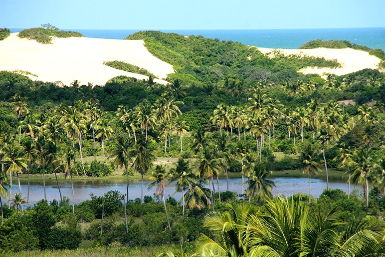
Dunes of Pacatuba
The dunes of Pacatuba are formed along the entire length between Ponta dos Mangues and Santa Izabel. They are paradisiacal dunes, very beautiful propcia for the practice of extreme sports.
Mirante and Dunes of Santa Izabel
The viewpoint of Santa Izabel is spectacular, something from another world, from there you can see the beach, the dunes and the lakes formed between the dunes. There the dunes are very high and have their vegetation intact.
Prainha
Prainha is another beach in Povoado Ponta dos Mangues. This beach is a leg of mangrove that gives access to the São Francisco River, passing through the Funil Island arriving at Cabeço.
Ponta dos Mangues and Boca da Barra beaches
The beach of Ponta dos Mangues is 23 km from the city of Pacatuba, in the village of Ponta dos Mangues. Despite being a deserted and calm beach, during hangovers the waves can reach more than 2 metres high, are sought after by surfers and tourists seeking contact with nature.
Pantanal Sergipano or Nordestino
The Pantanal of Pacatuba is less than two hours from Aracaju. It holds one of the most interesting visuals of the entire Brazilian Coast, It is the largest aquifer in the Northeast, where drinking water is abundant. There are 40 square kilometres interconnected by lagoons and covered with typical plants.
How to get there
The city of Pacatuba is located about 70 km from the capital Aracaju and the best alternative to go by car will be the BR-101 towards the north of the state, the road is well signposted and you will have no problems getting to the city of Pacatuba.
There is also a local track passing through Japaratuba, but we do not recommend it because it is almost all clay track, often with puddles and stretches of difficult access. It is very common for cars and even buses to get bogged down.
Tourism and Travel Guide for Sergipe and the Northeast of Brazil


