Este post também está disponível em:
![]() Português
Português ![]() English
English

PPiaҫabuҫu, in Alagoas, is located on the left bank of the São Francisco River, very close to its mouth, and its main attraction is the river.
Going by boat or buggy to the point where the waters of the Velho Chico meet the sea is a must.
The beach of Pontal do Peba, notorious for its shrimp fishing, invites you to take a relaxing stroll.
Piaҫabuҫu is 138 kilometres from Maceió on the AL – 101 and 26 kilometres from Penedo, on a paved road in good condition.
See the tourist map of Alagoas.
Tourist attractions of Piaçabuçu
Piaçabuçu em Alagoas03:23
Praia do Pontal do Peba Piaçabuçu em Alagoas07:32
Piaçabuçu - Rio São Francisco11:10
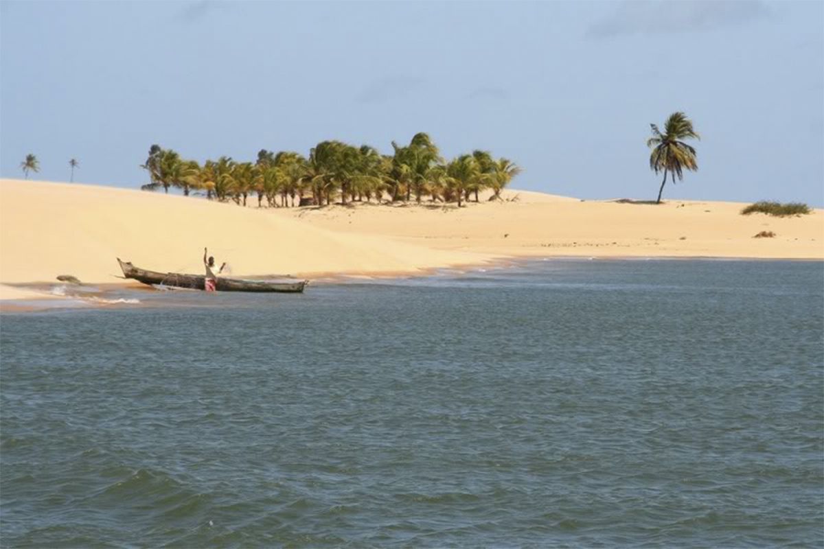
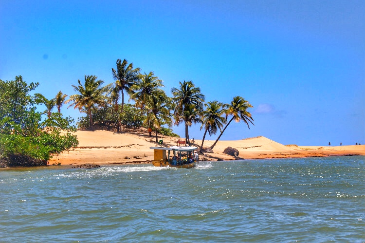
1. FOZ DO RIO SÃO FRANCISCO
There are several places where tourists can take a boat to travel the last 13 kilometres of the São Francisco River. In general, near the bars on the side of the road that leads to Piaҫabuҫu.
There is also the option of using the boatmen who stop at the quay in the town of Piaçabuçu.
The programme takes about two and a half hours (round trip) by sloop, amidst a landscape made up of mangroves and dunes. Near the mouth, the boat stops and passengers can walk to the meeting of the waters, a place that is part of the APA of Piaҫabuҫu.
The buggy is another viable form of transport: 21 kilometres in almost three hours along Pontal do Peba beach.
You cross farms to a point close to the dunes and from there continue on foot to the mouth.
If the courage allows, the tourist can travel from 3 to 5 kilometres in a parachute pulled by the buggy.
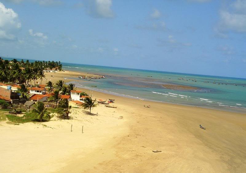
2. PONTAL DO PEBA BEACH

With 23 kilometres of extension, of which only two are urbanised, the beach of Pontal do Peba is 13 kilometres from the centre of Piaҫabuҫu.
The beach has fine sand and dunes in the background, and is one of the great centres of shrimp fishing in the Northeast.
With fine, beaten sand and dunes in the background, it is a spawning ground for sea turtles and one of the major shrimp fishing centres in the Northeast.
It is also suitable for spearfishing. One drawback: heavy traffic in some stretches, as inns and restaurants share space with fishermen’s and holiday homes.
3. through the curves of the são francisco river
The source of the São Francisco River springs in the Canastra mountain range in Minas Gerais and heads north-east, where it cuts through the arid lands of four states.
Its waters separate Bahia from Pernambuco and Sergipe from Alagoas, in a tortuous journey of approximately 3,000 kilometres until it flows into the sea.
The river bathes almost 500 municipalities, and since 1847 other cities have been pleading for a diversion to solve the water shortage in a hinterland of rare rainfall. The transposition project has been shelved and resumed internally, always under intense controversy.
In Bahia, the Velho Chico quenches the thirst of the population of Bom Jesus da Lapa, Barra and Juazeiro, cities that fervently revere the saint who baptises the river; the mysticism that accompanies it along the way is also evident in the famous carrancas – monstrous images placed on the bow of boats to scare away evil spirits.
Brazil’s first hydroelectric dam was built on the São Francisco – Angiquinho – in 1913. Today, the river is dammed at Sobradinho, Paulo Afonso and, further on, at Xingó, already in the state of Alagoas.
In the state of Pernambuco Petrolina, it irrigates fruit plants.
Its great tourist potential, however, is only well exploited in Canindé do São Francisco, in Sergipe, and in the Alagoas towns of Piranhas and Penedo, near the point where the beautiful meeting of its waters with those of the Atlantic Ocean occurs.

Tourism and Travel Guide to the São Francisco River in Alagoas


