Este post também está disponível em:
![]() Português
Português ![]() English
English

The north coast of Rio Grande do Norte has a rustic beauty that can be enjoyed in one or two-day trips, in buggies or four-wheel drive vehicles, until the border with Ceará.
The approximately 250 kilometers of coastline are a sequence of villages inhabited by fishermen, always bordered by semi-deserted beaches, with dunes, cliffs and calm waters dotted with rafts or boats.
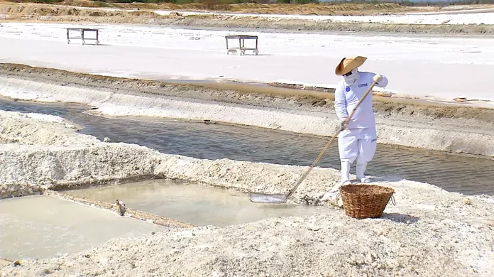
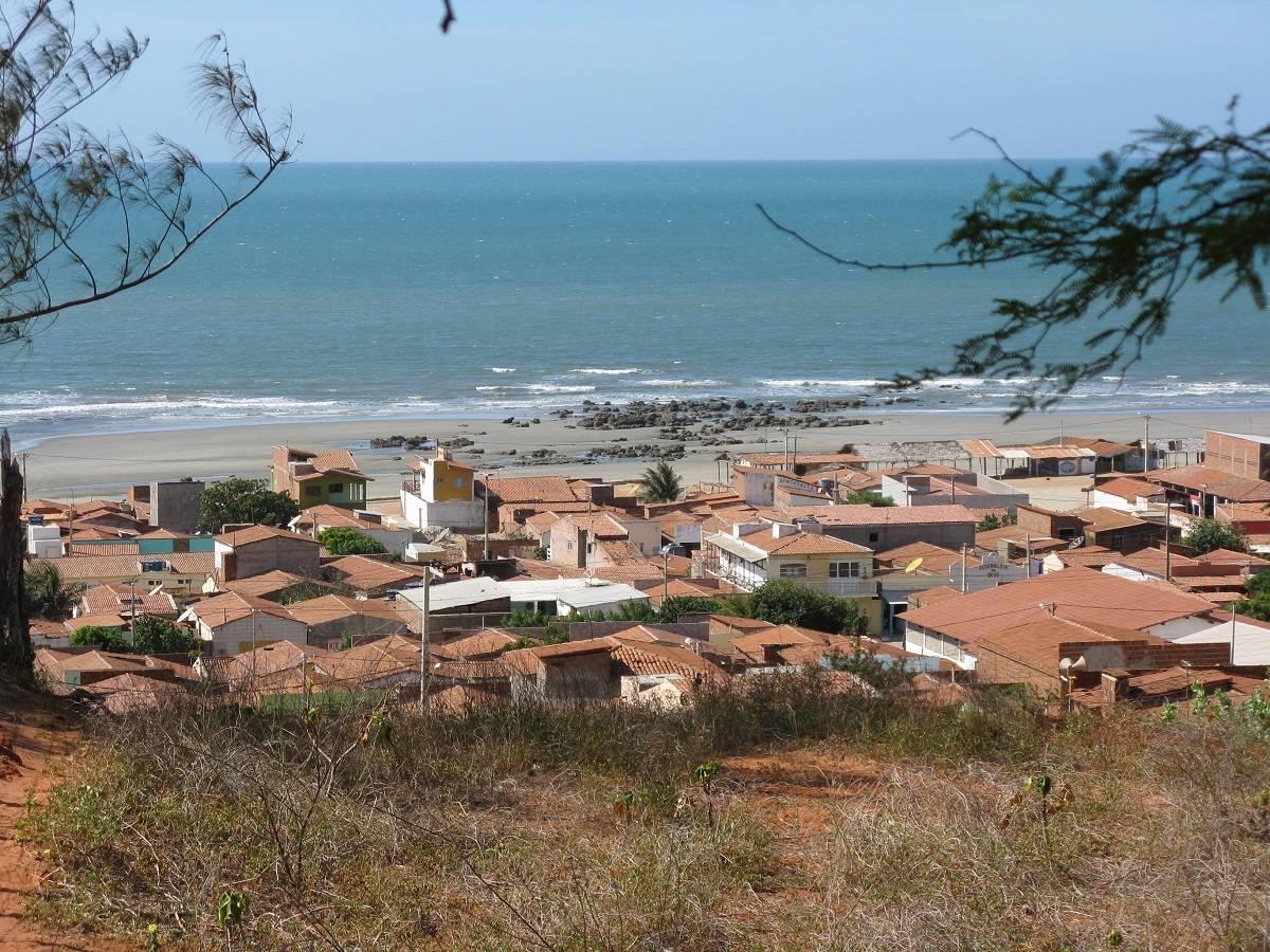
Among the villages are small gems, such as Touros, São Miguel do Gostoso, Galinhos and Ponta do Mel – this one already almost in Ceará lands, in the so-called Salt Coast or White Coast Pole, a reference to the salt pans that are concentrated in the region, especially around Mossoró, Macau and Areia Branca, where about 90% of Brazil’s salt is produced.
Watch the videos about the north coast of RN
Costa do Sal

São Miguel do Gostoso

Galinhos

Ponta do Mel
Areia Branca RN - Drone02:28
Areia Branca RN - Guia de Turismo03:16
NORTH COASTAL BEACHES OF RN
See the tourist map of Rio Grande do Norte
1. Touros in RN
Touros is a fishing community in RN with quiet sands and calm waters, protected by barrier reefs. It offers views of the Farol do Calcanhar.
2. São Miguel do Gostoso
São Miguel do Gostoso is an almost deserted beach, with calm waters, with stretches of boardwalk interspersed with huts.
3. Tourinhos
Tourinhos has a setting of brownish cliffs with vegetation that, sculpted by the waters, takes on sculptural forms that resemble old wooden trunks.
4. Praia do Marco
Praia do Marco is a straight and deserted strip of sand, with turtle spawning and calm sea. In winter, access is only by the beach.
5. Galinhos
Galinhos has a landscape of low dunes and inviting river and sea waters for swimming.
6. Ponta do Mel
Ponta do Mel is a wild beach in a beautiful cove surrounded by red cliffs and dunes, with calm sea suitable for swimming.
7. Tibau
Tibau on the border with Ceará, is frequented by vacationers from Mossaró. Dunes, coconut trees, cliffs and shallow, calm waters are part of the landscape.
The tents operate on weekends or in season.
8. Touros
The name Touros is due to a rock formation on the beach, similar to a bull’s head. Accessed by BR-101 and RN-221, Touros, 88 kilometers from Natal, is the most structured locality on the north coast.

It offers tourists calm sea beaches, with coconut trees and reefs; small houses on the shore and rafts scattered in the water complete the scenery.
9. Carnaubinha, Farol, Gameleira, Garças and Perobas beaches
In the latter, there is a diving point in the middle of the reefs: during low tide, speedboats take bathers for two hours of free diving in the stretch of reefs 6 kilometers long and 1.5 wide.
The Farol do Calcanhar, built in 1943, is the tallest in Latin America, 65 meters high and 9 meters high.
Only on Sundays are visitors allowed to climb its 298 steps to contemplate a beautiful landscape of contrasts: on one side, deserted beaches, the city of Touros and an infinity of sea; on the other, in the direction of Ceará, a descampado in shades of green and brown – there, after the curve (the “heel”) that the Brazilian territory delimits, the vegetation and climate typical of the semi-arid northeast begin.
MAIN VILLAGES OF THE NORTH COAST OF RN
1. SÃO MIGUEL DO GOSTOSO
Nobody knows for sure the origin of the name of the village and São Miguel do Gostoso, 105 kilometers from Natal.
“São Miguel”, of course, pays homage to the angel; the explanation for the rest is nebulous: some attribute the “gostoso” to a popular character with a contagious laugh – gostosa.

Be that as it may, the village is indeed a pleasant place, where tourism has not changed the routine of fishing, labyrinth lace and artisanal flour production.
In the center, the Caldeiro farmhouse, the first local house, now converted into a guesthouse, still stands; there is also the small Praça dos Anjos.
Those who visit São Miguel do Gostoso from August to January, during the “farinhada” period, can go to one of the more than twenty flour houses and learn about the artisanal work of transforming manioc into flour and gum to make tapioca (Freijós community, s/n, 20 km from the center).
The beaches of this stretch of coastline, still quite virgin, are calm waters, with few summer houses, populated by rafts and bordered by low and sparse vegetation.

They can be explored by buggy at low tide.
The beach of Ponta do Santo Cristo is the most suitable for windsurfing.
The scenery of Tourinhos beach stands out for its beautiful cliffs.
On Marco beach you can see a crude replica of the Portuguese landmark – the original piece was transferred to the capital of Rio Grande do Norte.
Access to São Miguel do Gostoso is via BR-101 and RN-221 on a road with good signaling.
2. GALINHOS
Galinhos is the destination of the most adventurous travelers, who sail the northeastern coast with buggy or four-wheel drive vehicle, the tiny Galinhos, 175 kilometers from Natal, is reached by BR-406, followed by RN-402, with bumpy stretches.
Cars do not enter the village; they are parked at a support point on the banks of the Pratagi River, which is crossed by boat.

On the other side of the river, you can see a peninsula with a charming and picturesque scenery: sandy floor – that’s why transportation is done in carriages -, rustic landscape, stripped inns maintained by locals, TV in the middle of the square on until very late.
At the back, the village (which owes its name to the dory, abundant there) meets the sea in a stretch of low dunes, with not very rough waters, inviting to bathing.
During the wooden motorboat rides through the surroundings on the rivers Pratagi, Aratuá and do Capim, the visitor can appreciate the richness of the mangrove, the small freshwater beaches on islets and the white mountains of salt.
3. PONTA DO MEL
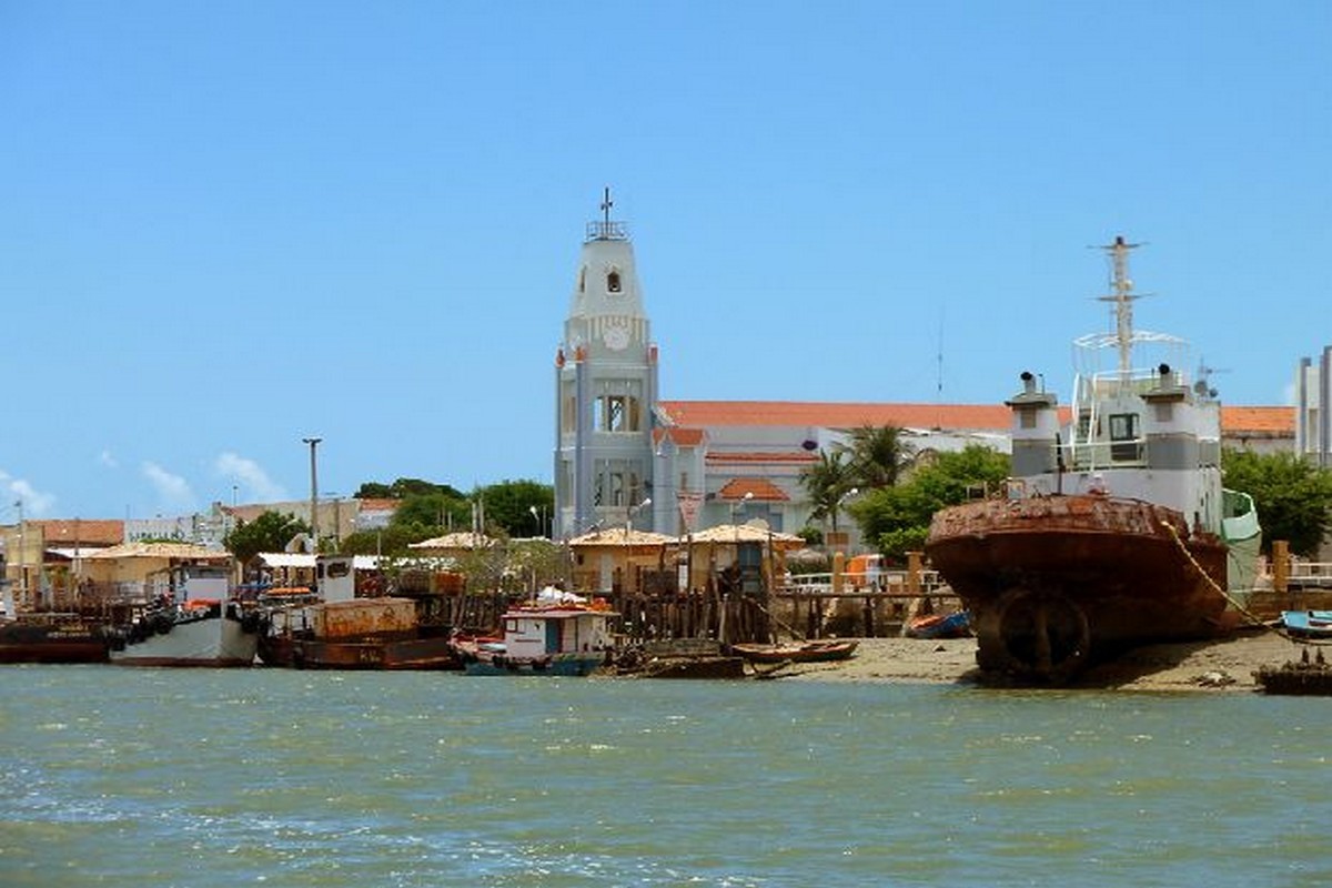
Ponta do Mel belonging to the municipality of Areia Branca and frequented by Mossoroenses, the rustic village of Ponta do Mel – the name alludes to the production of wild honey in the nearby Serra do Mel – seems to have been built on sidewalks: the houses descend from the top of the cliffs to the edge of the deserted beach.
Those at the top, where the Ponta do Mel Lighthouse is located, have a privileged view of reddish cliffs, dunes and a sea as far as the eye can see.

The landscape of this place 355 kilometers from Natal brings together stretches of caatinga, with some mandacarus and macambiras, as well as goats and donkeys.
It is worth stretching the tour and visiting the beach of São Cristóvão, quite deserted, great for watching the sunset.
Ponta do Mel can be reached by car along the BR-110 highway, or by four-wheel drive vehicle along the BR-304 highway to Porto do Mangue, from where the route continues over the dunes on a beautiful sandy road.
The second route requires caution: it is not signposted and has no gas stations; it is essential to fill up in advance.
Just before Ponta do Mel is Rosado beach, named after the pink hues of the dunes.
Enjoy the sunset from this point, when the pink colors of the dunes mix with those of the sky, in an unforgettable spectacle.
Tourism and Travel Guide of the North Coast of Rio Grande do Norte


